Independent economic studies for the governments, developers, and businesses of Central Oregon, built on Deschutes County's own federal data and designed to hold up when a lender or a funder reviews them.
| Largest sectors by employment | Jobs | Concentration |
|---|---|---|
| Health care & social assistance | 15,316 | 1.09x |
| Retail trade | 11,862 | 1.27x |
| Accommodation & food services | 11,695 | 1.38x |
| Construction | 8,334 | 1.71x |
| Manufacturing | 6,192 | 0.8x |
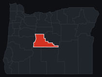
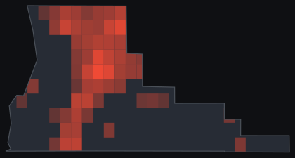
Source: U.S. Bureau of Labor Statistics, Quarterly Census of Employment and Wages, 2023 annual averages, Deschutes County. Concentration is a location quotient (county sector share of employment divided by the national share), computed by Project Red Team. Covered jobs exclude the self-employed and some agricultural workers.
Deschutes County runs on roughly 92,080 covered jobs across 12,028 establishments, at an average annual wage of $62,436, in a job base that grew 3.9% in the most recent year, a pace well above what most rural counties in the interior West see. Health care and social assistance is the largest sector by headcount, 15,316 jobs anchored by St. Charles Health System, followed by retail trade, accommodation and food services, construction, and manufacturing, the layered economy of a metro area serving both a growing resident population and a steady flow of visitors. The concentration numbers point somewhere more specific: construction runs at 1.71 times the national employment share, agriculture, forestry, and fishing at 1.7 times despite a modest headcount, arts, entertainment, and recreation at 1.65 times, and accommodation and food services at 1.38 times. Read together, that is a county still building itself to keep up with the people moving in, with a visitor and recreation economy, built around Mt. Bachelor and the Deschutes River, that pulls more weight than its raw job count alone would suggest.
Deschutes County's economy centers on Bend and Redmond, a high desert metro area that has grown from a timber and ranching base into health care, tourism, and outdoor recreation. St. Charles Health System, the region's largest employer, operates hospitals in Bend, Redmond, Madras, and Prineville. Around it sits the retail, hospitality, and services base a fast-growing metro of this size needs, serving both residents and the visitors who come for Mt. Bachelor, the Deschutes River, and a craft brewing scene anchored by Deschutes Brewery. A newer bioscience and manufacturing sector, including Lonza's long-running Bend operation, has grown alongside the traditional employers, and a sustained housing boom keeps construction running well above its national share of the workforce. Ranching and irrigated hay and alfalfa persist on the high desert's edges, drawing on the same Deschutes River water that supplies the cities and the recreation economy downstream.
A destination resort, a hospital expansion, a manufacturing plant, a ski area upgrade, or a new subdivision here all turn on the same test: whether the project adds jobs and tax revenue that would not otherwise exist, or simply competes for the water, land, and workers that a dozen other projects in the same growing county are also chasing. Water is the tightest constraint of all. The irrigation districts that serve the basin already draw the large majority of the Deschutes River's flow during the growing season, and a project that touches groundwater or river flow has to be measured against that reality from the start.
The obvious candidate to model here is the Thornburgh Destination Resort, a nearly 2,000-acre master-planned resort proposed since 2005 on the high desert southwest of Cline Butte, near Redmond, permitted for up to 950 homes and 380 overnight lodging units across two golf courses. The project has drawn seven rounds of appeals since 2006, and the county's approval was remanded again by the Oregon Land Use Board of Appeals in February 2025, with the Confederated Tribes of Warm Springs pressing treaty fishing-rights and groundwater-and-fish-habitat claims that reached the Oregon Court of Appeals in 2024. Both sides have made public claims about the resort's jobs, tax revenue, and water impact for two decades without a neutral study settling any of it. That is exactly the kind of contested, high-stakes number an independent, source-traceable analysis exists to referee.
Public-data path: regional input-output multipliers, free-data regionalized or drawn from a purchased BEA RIMS II order where a project supplies one, BLS QCEW and Census LODES for the local labor base, USDA NASS for the county's irrigated agriculture, and the public case record Deschutes County and the Oregon Land Use Board of Appeals have published on the Thornburgh docket.
We produce the study first: economic impact (what a project brings to Deschutes County, in jobs, output, and tax revenue, with local leakage handled honestly), feasibility and viability (whether it should move forward, measured with the finance a lender runs), and fiscal impact for public budgets and grant applications. Every engagement returns a full report, a one-page brief, a reviewer pack, and a decision package.
And if a study is already in hand, we review it: we inventory its quotable claims, attach the evidence, and tell you plainly what survives review before you quote it or fund against it. More on reading a study before you rely on it.
National firms fly in, bill the travel, and price a county like Deschutes out of the analysis its own growth demands. We work across the interior West, we can be on-site in Bend or Redmond, and we build every study on the county's measured federal record, the same BLS and Census data behind the numbers above, so the result traces to a public source and survives scrutiny.
Have a project in Deschutes County? Tell us what you are weighing and where. We will lay out what it takes to answer it, and what it costs.
Commission a study